Madera Proposal
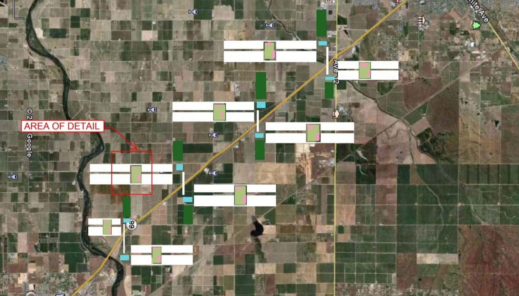
The proposed Settlement Pattern is located between Madera and Fresno, along Highwy 99, in California's Central Valley. The land is organized by the grid pattern originally established by Thomas Jefferson in the national survey of 1785, and which is used throughout the United States as the formal basis for land planning and distribution. Farmland is becoming increasingly valuable as more is replaced with residential and commercial development. This proposal overlays new residential development on farmland in an integrated pattern designed to support a growing population while preserving the agricultural land use of the region.
The population of Fresno is 909,000 residents in approximately 120,000 acres or just under 8 persons per acre in continuous settlement that as it grows continues to overtake arable land. Were the development of this region to continue at the current density, the area between Madera and Fresno would eventually be filled with urban settlement, completely replacing the arable land. This study illustrates an alternate development pattern that accommodates nearly half a million new residents between the two cities while preserving approximately 60% of the current agricultural landscape.
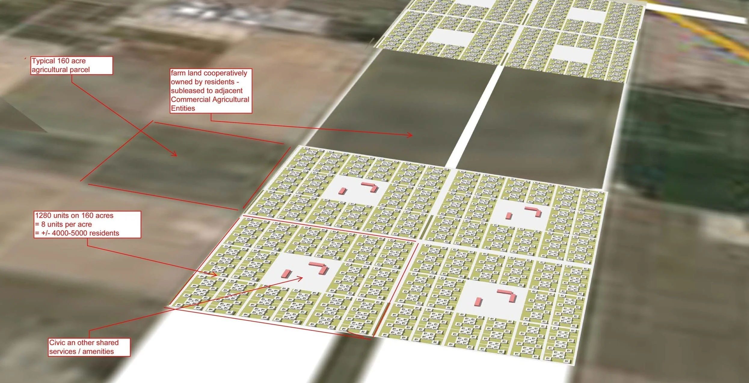
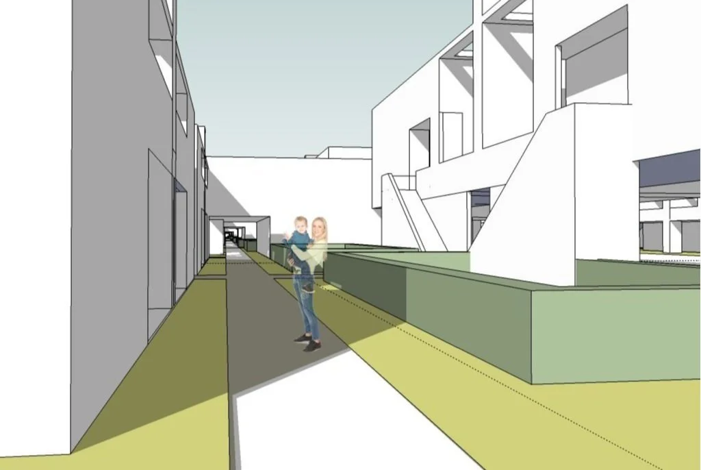
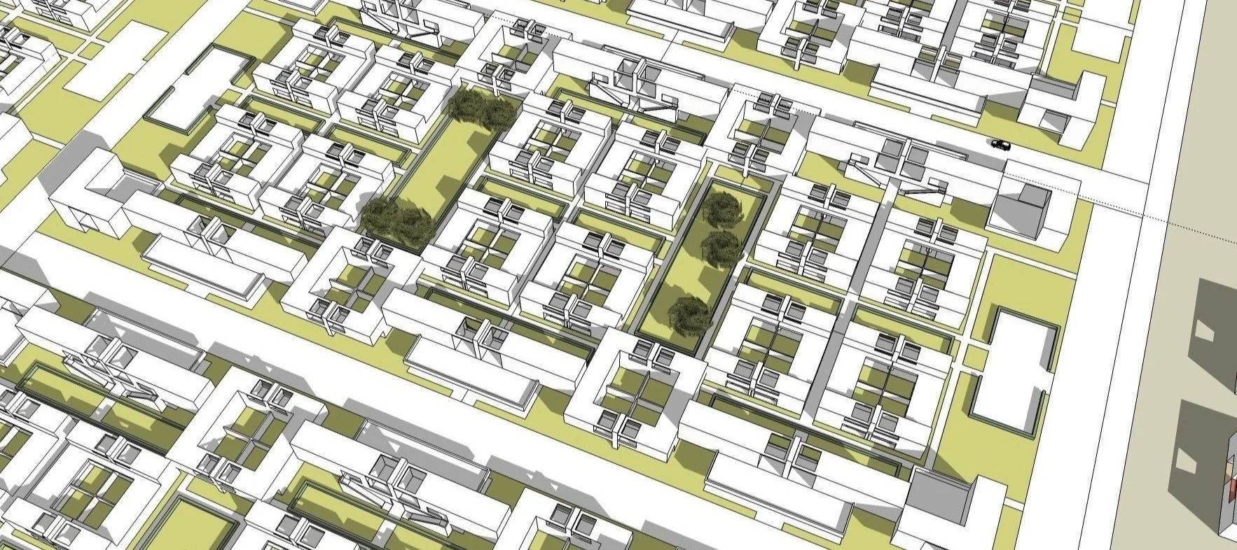
The proposed settlement is 3 to 4 times the density of Fresno in a pattern that is integrated formally and programmatically with the existing agriculturally-based landscape. The basic unit of land is the 160 acre parcel that forms the patchwork landscape visible in this aerial view. The residential planning is based on a carpet-housing typology, a courtyard-based planning strategy that enables both shared and private outdoor landscape for every unit. Each rectangular Settlement includes 10 to 14 160 acre parcels, each in a nine-square grid. The middle square of each parcel is reserved for civic and other shared amenities. A 320 acre portion of agricultural land is contained within each rectangular settlement, which is to be retained cooperatively for the benefit of the residents.